A new map of the terrain beneath the Greenland Ice Sheet connects hundreds of hidden valleys, improving predictions for global ice flow and sea level rise.
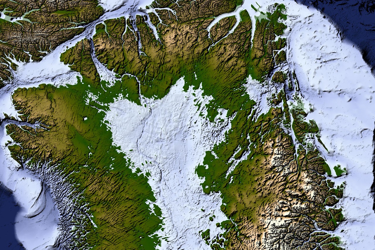
A newly developed map of the bedrock beneath the Greenland Ice Sheet has revealed hundreds of interconnected subglacial valleys that earlier topographies failed to detect or left fragmented.
The updated topography provides a continuous view of the subglacial landscape, resolving long-standing gaps in radar data and satellite observations across the island's vast interior.
Role of subglacial terrain in ice flow
Deep valleys beneath the ice sheet serve as natural channels, directing the movement of glacier ice and subglacial meltwater toward the Atlantic Ocean. When topographic maps leave these features disconnected, predictive computer models struggle to simulate how fast ice glides across the bedrock.
By joining these previously fragmented valley systems, the map enables researchers to trace continuous pathways stretching from deep interior drainage basins directly to coastal outlet glaciers.
Airborne ice-penetrating radar systems collect topographical data by sending radio signals through kilometers of ice to reflect off underlying rock. In regions where historical flight paths were widely spaced, earlier data processing created artificial interruptions along continuous bedrock channels.
Impact on sea level projection models
Glaciologists rely on precise bedrock mapping to evaluate the long-term structural stability of the ice sheet under shifting climate conditions. Uncharted bedrock ridges or hidden troughs can either decelerate ice movement or accelerate discharge into surrounding marine channels.
Incorporating the connected valley networks into existing numerical models clarifies how subglacial water lubricates the boundary between ice and rock. The refined dataset reduces uncertainty in projections regarding Greenland's contribution to global sea level rise.
Key structural findings
- Discovery of continuous valley networks across previously isolated data zones
- Clearer mapping of subglacial drainage routes toward major coastal outlets
- Reduction of computational errors in regional ice velocity simulations
- Improved baseline data for measuring future ice sheet mass loss
The updated topographic dataset provides a reliable baseline for upcoming geophysical surveys seeking to track ongoing ice thickness changes across Greenland.



0 Comments